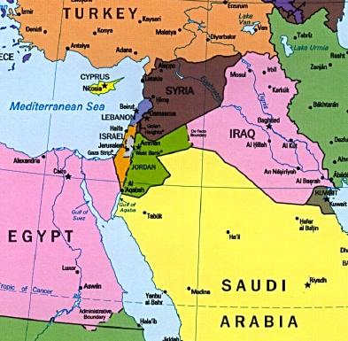
political
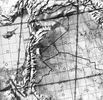
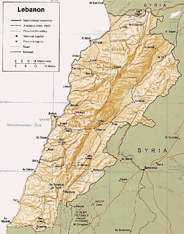
topographical
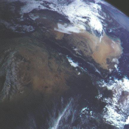
from sky
Geographic coordinates: 33 50 N, 35 50 E
Some nice maps:
political |
topographical |
from sky |
+7 hours Eastern Standard Time
Area:
Total area: 10,452 sq km (4,015 sq mi)
Land area: 10,230 sq km
Comparative area: about 0.8 times the size of Connecticut
Land boundaries:
Total 454 km: Israel 79 km, Syria 375 km
Coastline:
225 km
Maritime claims:
Territorial sea: 12 nm
International disputes:
Separated from Israel by the 1949 Armistice Line; Israeli troops in southern Lebanon since June 1982; Syrian troops in northern, central, and eastern Lebanon since October 1976.
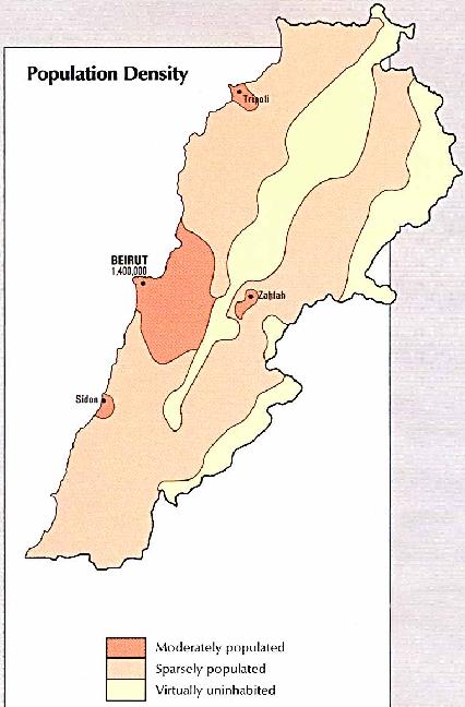
Cities:
Capital: Beirut (1 million).
 |
Other cities: Trablous (240,000), Saida (110,000), Sour (60,000), Zahleh (55,000).
Rivers and Lakes:
Main river: Litani.
Other rivers: Nahr al Kalb, Orontes, Nahr Barada.
Climate:
Mediterranean; mild to cool, wet winters with hot, dry summers; Lebanon mountains experience heavy winter snows.
Terrain:
Narrow coastal plain; Al Biqa' (Bekaa Valley) separates Lebanon and Anti-Lebanon Mountains.
Lowest point: Mediterranean Sea 0 m
Highest point: Jabal al Makmal 3,087 m
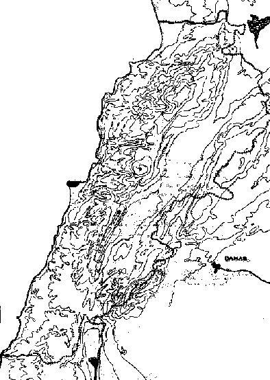 topographical map |
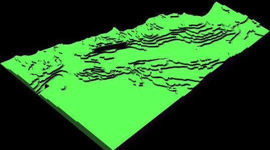
3d map (southeast) |
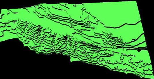 3d map (west) |
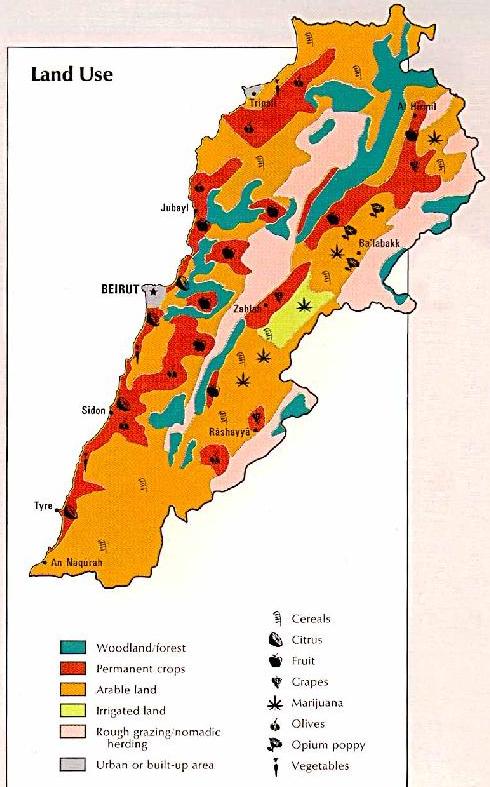
Arable land: 21%
Permanent crops: 9%
Meadows and pastures: 1%
Forest and woodland: 8%
Urban: 61%
Irrigated land: 860 sq km (1990 est.)
Environment:
Current issues: Deforestation; soil erosion; desertification; air pollution in Beirut from vehicular traffic and the burning of industrial wastes; pollution of coastal waters from raw sewage and oil spills.
Natural hazards: dust storms, sandstorms
International agreements:
party to: Biodiversity, Climate Change, Hazardous Wastes, Law of the Sea, Nuclear Test Ban, Ozone Layer Protection, Ship Pollution
signed, but not ratified: Desertification, Environmental Modification, Marine Dumping, Marine Life Conservation
Note:
Nahr al Litani only major river in Near East not crossing an international boundary; rugged terrain historically helped isolate, protect, and develop numerous factional groups based on religion, clan, and ethnicity.
Population: 3,776,317 (July 1996 est.)
Population growth rate:
1.98% (1994 est.)
2.16% (1996 est.)
Birth rate:
27.89 births/1,000 population (1994 est.)
27.93 births/1,000 population (1996 est.)
Death rate:
6.55 deaths/1,000 population (1994 est.)
6.35 deaths/1,000 population (1996 est.)
Net migration rate:
-1.52 migrant(s)/1,000 population (1994 est.)
0 migrant(s)/1,000 population (1996 est.)
Sex ratio:
at birth:1.05 male(s)/female
under 15 years:1.04 male(s)/female
15-64 years:0.9 male(s)/female
65 years and over:0.85 male(s)/female
all ages:0.95 male(s)/female (1996 est.)
Infant mortality rate:
39.5 deaths/1,000 live births (1994 est.)
36.7 deaths/1,000 live births (1996 est.)
Life expectancy at birth:
Total population: 69.35 years (1994 est.)
Total population: 69.99 years (1996 est.)
Male: 66.92 years (1994 est.)
Male: 67.49 years (1996 est.)
Female: 71.90 years (1994 est.)
Female: 72.62 years (1996 est.)
Total fertility rate:
3.39 children born/woman (1994 est.)
3.24 children born/woman (1996 est.)
Nationality:
Noun: Lebanese (singular and plural)
Adjective: Lebanese
Ethnic divisions:
Arab 95%, Armenian 4%, other 1%
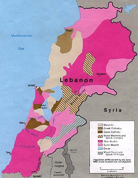
Islam 70% (5 legally recognized Islamic groups - Alawite or Nusayri, Druze, Isma'ilite, Shi'a, Sunni), Christian 30% (11 legally recognized Christian groups - 4 Orthodox Christian, 6 Catholic, 1 Protestant), Judaism NEGL%
Languages:
Arabic (official), French (official), Armenian, English
Literacy:
Age 15 and over can read and write (1995 est.)
Total population: 80.0% (1990 est.)
Total population: 92.4% (1995 est.)
Male: 88.0% (1990 est.)
Male: 94.7% (1995 est.)
Female: 73.0% (1990 est.)
Female: 90.3% (1995 est.)
Labor force:
650,000 by occupation:
Industry, commerce, and services 79%, agriculture 11%, government 10% (1985)
Source: CIA, World Fact Book 1994, 1996
| Main Page
| Geography
| History
| Tourism
| Economy
| Politics
| Culture
| Science
| Sports
| Index |
© 1997-2001 by Ayman Ghaziayman@ghazi.de
Last changes: September 30, 1997